Why bother with What Three Words?
By @edent![]() · maps open standards standards what3words · 157 comments · 1,150 words · read ~202,776 times.
· maps open standards standards what3words · 157 comments · 1,150 words · read ~202,776 times.
I'll be wording this post carefully as What 3 Words (W3W) have a tenacious PR team and, probably, have a lot more lawyers than I do.
W3W is a closed product. It is a for-profit company masquerading as an open standard. And that annoys me.
A brief primer.
- The world is a sphere.
- We can reference any point on the surface of Earth using two co-ordinates, Longitude and Latitude.
- Long/Lat are numbers. They can be as precise or as vague as needed.
- Humans can't remember long strings of numbers, and reading them out is difficult.
W3W aims to solve this. It splits the world into a grid, and gives every square a unique three-word phrase.
So the location 51.50799,-0.12803 becomes ///mile.crazy.shade
Brilliant, right?
No.
Here's all the problems I have with W3W.
It isn't open
The algorithm used to generate the words is proprietary. You are not allowed to see it. You cannot find out your location without asking W3W for permission.
If you want permission, you have to agree to some pretty long terms and conditions. And understand their privacy policy. Oh, and an API agreement. And then make sure you don't infringe their patents.
You cannot store locations. You have to let them analyse the locations you look up. Want to use more than 10,000 addresses? Contact them for prices!
It is the antithesis of open.
Cost
W3W refuses to publish their prices. You have to contact their sales team if you want to know what it will cost your organisation.
Open standards are free to use.
Earthquakes
When an earthquake struck Japan, street addresses didn't change but that their physical location did.
That is, a street address is still 42 Acacia Avenue - but the Longitude and Latitude has changed.
Perhaps you think this is an edge case? It isn't. Australia is drifting so fast that GPS can't keep up.
How does W3W deal with this? Their grid is static, so any tectonic activity means your W3W changes.
Internationalisation
Numbers are fairly universal. Lots of countries use 0-9. English words are not universal. How does W3W deal with this?
Is "cat.dog.goose" straight translated into French? No! Each language has its own word list.
There is no way to translate between languages. You have to beg W3W for permission for access to their API. They do not publish their word lists or the mappings between them.
So, if I want to tell a French speaker where ///mile.crazy.shade is, I have to use ///embouchure.adjuger.saladier
Loosely translated back as ///mouth.award.bowl an entirely different location!
You're not allowed to know what word lists W3W use. They take a paternalistic attitude to creating their lists - they know best. You cannot propose changes.
Anecdotally, their non-English word lists are confusing even for native speakers.
Cultural Respect
Numbers are (mostly) culturally neutral. Words are not. Is "mile.crazy.shade" a respectful name for a war memorial? How about ///tribes.hurt.stumpy for a temple?
How do you feel about ///weepy.lulls.emerge and ///grouchy.hormone.elevating both being at Auschwitz? Or ///klartext.bestückt.vermuten - "cleartext stocked suspect"?
This is a classic computer science problem. Every sufficiently long word list can eventually be recombined into a potentially offensive phrase.
Open Washing
W3W know that the majority of technical people are not fooled by their attempts to lock down addressing.
They include this paragraph to attempt to prove their openness:
If we, what3words ltd, are ever unable to maintain the what3words technology or make arrangements for it to be maintained by a third-party (with that third-party being willing to make this same commitment), then we will release our source code into the public domain. We will do this in such a way and with suitable licences and documentation to ensure that any and all users of what3words, whether they are individuals, businesses, charitable organisations, aid agencies, governments or anyone else can continue to rely on the what3words system.
I don't know how they propose to bind a successor organisation. They don't say what licences they will use. If they go bust, there's no guarantee they'll be legally able to release this code, nor may they have the time to do so.
There's nothing stopping W3W from releasing their algorithms now, subjecting them to scrutiny by the standards community. They could build up a community of experts to help improve the system, they could work with existing mapping efforts, they could help build a useful and open standard.
But they don't. They guard their secrets and actively promote their proprietary product in the hope it will become widely accepted and then they can engage in rent-seeking behaviour.
This is not a new argument
My mate Leigh wrote about this three years ago. Lots of people have criticised W3W.
.@what3words is bad technical idea, and ethically terrible too. But all VCs like patented economic rents so the juggernaut rolls on. #geomob
— Andy Allan @gravitystorm@gravitystorm.co.uk (@gravitystorm) July 14, 2016
But W3W have a great PR team - pushing press releases which are then reported as uncritical news.
The most recent press release contains a ludicrous example:
- Person dials the emergency services
- Person doesn't know their location
- Emergency services sends the person a link
- Person clicks on link, opens web page
- Web page geolocates user and displays their W3W location
- Person reads out their W3W phrase to the emergency services
Here's the thing... If the person's phone has a data connection - the web page can just send the geolocation directly back to the emergency services! No need to get a human to read it out, then another human to listen and type it in to a different system.
There is literally no need for W3W in this scenario. If you have a data connection, you can send your precise location without an intermediary.
What Next?
W3W succeeds because it has a superficially simple solution to a complex problems. It is a brilliant lesson in how marketing and PR can help a technologically inferior project look like it is a global open solution.
I'm not joking. Their branding firm says:
Edelman helped what3words frame their story to be compelling by tapping into human emotion.
We also created a story for CEO Chris Sheldrick about how having an address can drive social transformation and business efficiency, securing profiling and speaker opportunities.
Through paid social campaigns we re-targeted these stories, getting through to the decision makers that mattered most.
We articulated their purpose narrative and refined their strategy to engage investors and excite the media.
It takes too much time to refute all their claims - but we must. Whenever you see people mentioning What3Words, politely remind them that it is not an open standard and should be avoided.
Your periodic reminder that W3W is a closed and proprietary system, with opaque licencing, hefty pricing, and poor internationalisation.
It does have a very good PR team though. https://t.co/Ch3e9cAfsn— Terence Eden is on Mastodon (@edent) March 26, 2019


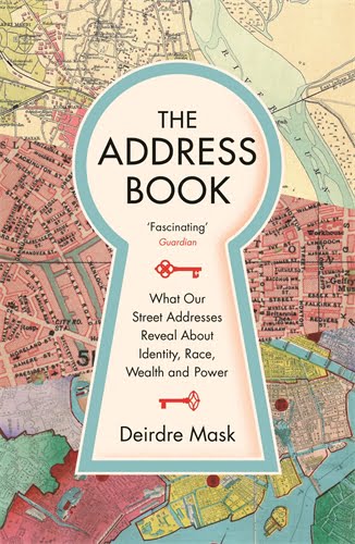 Book Review: The Address Book: What Street Addresses Reveal about Identity, Race, Wealth and Power by Deirdre Mask
Personally I really like w3w and their solution is certainly novel, I take your point about an open standard but equally these people have worked to create a novel and effective solution so why shouldn't they be able to profit from their labour?
We could apply the same argument to say UK Postcodes, despite the creation of the system having been funded out of public money (when the Royal Mail was state owned) they still want to charge people for access to the dataset? At least w3w have a nice API and is free for basic use, more than can be said for Royal Mail
I agree that W3W should be allowed to profit from their labour. I just think they should be more honest about the fact it is proprietary and that they should stop spinning it as an globally useful open standard.
I also agree that RM's postcodes are also a closed system - and have been fighting against that for ages 🙂
This seems like a false dichotomy. An open standard can be completely compatible with income.
For example, what3words could sell services around the standard, akin to SUSE selling support for Linux (and doing very well at that). Or, perhaps more immediately comparable, look at the OpenStreetMap ecosystem which has plenty of businesses like Klokan Technologies and Geofabrik.
From a business point of view the openness could actually lead to adoption and increased demand for the services.
There is nothing open about requiring API call to transform a number string to word string! Google BIP39! This ”service” is the most ridiculous product ever!
Sigmundur - exactly, it's not an open standard, and probably never will be.
The point is that there is no theoretical conflict between an open standard and paid services.
Thinking GPS coordinates needs an equivalent of DNS does not seem terribly novel, and how is the solution effective?? Go to another country and suddenly nobody will understand. Tell someone you are at location "one.two.three" and they will probably also respond with three words: "WTF"
Personally I instinctively hated that idea when I first glanced it in my FB feed, and there is NOTHING novel about their ”solution” of encoding number strings to word strings. That this process isn’t open and deterministic is a HUGE red flag to any semi-technical person. Or should be.
API niceness is irrelevant when service is useless. Wrap a turd in gold paper, it’s still a turd. Your Royal Mail APIs can be whatever, but at least you won’t need to pay to find out your postal code. Your postal code system isn’t funded by VCs.
Just take the word of people who DO have a clue.
Hi Mr Machin, I agree with you.
This is, however a good discussion and I do take the many points made by the original poster (Terence Eden - thanks Mr Eden for your blog). But... (i) There is nowt to stop countries which do not speak English as a first language or prefer a different system from developing one. (ii) Open-source products are fine in theory but capitalist economies cannot be run on open-source all the time (should I expect Tesco to give me the goods? or, indeed, anyone to work for free? If people wish to do that, fine but it is not economically sustainable). (iii) I loathe numbers - I find them really difficult. I fully accept the accuracy and flexibility arguments but I never used latitude / longitude to determine where to meet people for a walk (too confusing for my innumerate brain); I do use W3W. (iv) I do not care - nor should anyone in my view - about the precise words; they are in a different context here - they are not being used as words in prose nor poetry; they are used as words simply to easily codify a location - perceived inappropriate words are not inappropriate because they are not intended as contextural writing, just that code. (v) I have actually told the Ambulance service where to find a lady who needed assistance using W3W - it was quick and easy (and accurate). So I fully accept the pure arguments against but this product is fab because it makes like so much easier. All the best all.
As a native german speaker:
This example seems benign to me - it's "suspect" as in "guess" as a verb, not a criminal suspect. (And stocked like a store shelf would be)
Thanks for letting me know! The perils of autotranslate 🙂
Which actually illustrates the problem of translation issues beautifully, what is benign is one language can be loaded with innuendo in a translation.
Another problem I see is its lack of relation to actual geography. People have already named places around the world in their own ways. We should adapt to them, not the other way around.
The quest for the optimal addressing system goes on.
Hi, with respect I do not agree in your conclusion. As I said in my other post... "(iv) I do not care – nor should anyone in my view – about the precise words; they are in a different context here – they are not being used as words in prose nor poetry; they are used as words simply to easily codify a location – perceived inappropriate words are not inappropriate because they are not intended as contextural writing, just that code." In t'other words, this W3W designation in (in no way) intended to compete - much less, replace - a placename. It is merely an easy-to-convey code to locate somewhere. For example (and this is just made-up, not a real code nor place) I would not say meet me at "Tired.Shelter.Mongoose" - well, I could to a close friend but I would say something like "Meet me at Vyne Wood... car park at Tired.Shelter.Mongoose" etc. Vyne Wood remains the name of the woodland - if planners bulldoze it and put an airport there Tired.Shelter.Mongoose now represents somewhere in that airport but precisely the same place on the globe. Therefore, it does relate to geography: the geography of our planet - as opposed to whatever is there this week, year, century etc. Hence, this is just a grid-reference made accurate and easy, that's all - but it is (at least for me) a big deal. Cheers.
The problem with using geographic names is that they are often not unique which can lead to confusion. If I tell someone that I’ve fallen and hurt myself about a kilometer north of San Vincente then if I’m in the Phillipenes the person has to work out which of teh 40+ San Vincentes I’m referring to….
Also people frequently have different names for some geographical locations, particularly locals. I once stayed in a village that had an official name that was on signposts and maps but which had a completely different name 100 years before and the vast majority of locals all still referred to it by the original name, and to make matters worse they mostly used a shortened version of the original name that was fairly un-unique.
Furthermore if I’m wandering about in a massive open extent of forest I might only be able to tell someone the name of the forest and there may be no local geographic name for the bit of it I’m standing in, the nearest identifiable named location could be a kilometer away, not very precise.
The problem with WTW is not that it is a bad idea, it’s actually a very good idea that is likely to work well in many circumstances, but more that the system is not open, or linguistically universal and therefore shouldn’t be considered some sort of global standard. It has its flaws but so do most other forms of location id, whether that be accuracy, vulnerability to change, ease of use, interoperability, universality, risk of mis-reading or miscommunication or a requirement to have access to certain equipment (such as an electronic device) or lack of an open standard. Yes it does concern me that increasing use of it may put a lot of reliance on the whims of a commercial company, but GPS itself is available at the whim of the US government or a military jamming aicraft so in some situations you may have problems trying to rely on it, whether it is through WTW or just for log/lat or a local grid ref. Maps are great but they require an an ability to read them and accurately report a coordinate system (which a surprising number of people can’t), plus if you have no location device and you can’t identify any map features then they ain’t much use. No system is perfect in all situations, WTW is just another method that can be used and for many people it will be the easiest, most accurate and least likely to be messed up.
FWIW there's a standard called OLC/Pluscodes, which achieves a similar thing and is actually open: https://en.wikipedia.org/wiki/Open_Location_Code
Well, but then you need a special webpage made by the emergency services. They didn't have that; they just had what3words. You don't get to disparage things that exist in favour of things that don't exist.
You could of course try to build that page for emergency services, sell it to them, and have them maintain it. Or, you know, the dispatcher could just tell the person to open what3words...
You are correct. I took their press release to mean that they had a special page for emergency services. Their videos make it clear they're just sending a generic text - https://what3words.com/mapsitecontrol/
As it happens, I did build a similar site many years ago when working for a telco. It was half-a-dozen lines of JavaScript, POSTing back to a server. I'll see if I can drag out the code.
Actually wouldn’t the link be even more useful if it just auto-responded with the GPS Geo Location like the phone already has? That way you wouldn’t need to rely on a data download of graphics for a map, or someone who might not be able to speak, as opposed to a few bits being uploaded to a web-server and that doing all the back end translation from a compressed format? Assuming the 51.50799,-0.12803 example was easier to send compressed as opposed to plain text or in hex/binary?.
Or, why not have Google and Apple make it so that calls to emergency services from a mobile device automatically report the device location?
Wot, you mean something like this?
https://crisisresponse.google/emergencylocationservice/how-it-works/
https://home.bt.com/tech-gadgets/tech-news/google-has-created-a-new-location-tool-to-help-emergency-services-find-you-faster-11364075879276
It's only been in place since 1996... :rolls eyes:
Most mobile phones that have some form of Gps chip and access to fairly accurate coordinates from built in applications. iOS has the compass app
There are now several different services in use by emergency services that send a text to a lost person, person clicks on link and that automatically sends location to emergency services. “SARLOC”, “Phone find” etc
You can send SMS messages to 999 if you pre register with them. It’s for the deaf community but handy in an emergency. I suspect they plan on being bought up by a google or such like so holding onto the copyright until then.
So if I have data.. Why can't I use my WhatsApp to send my location?
Are you emergency services available over WhatsApp? I expect the answer today is "no", and there are arguments to be made both for and against having state-funded services made available on a private platform like WhatsApp...
How am I supposed to send my 3 words to someone if there’s no services available? That’s the part I don’t understand.
If you have signal on any operator, you will be able to place a 999 call.
Actually… Mobile providers have been screaming at manufacturers for years about this. Google were the first to implement an answer. Go lookup Advanced Mobile Location.
Supported by Apple and Android for some time now. (Google since 2010 and Apple shamefully since 2018). And it’s a simple enough standard… You dial 999 (or local emergency code in the country you’re in), phone turns on WiFi/location services and either texts or HTTP posts the location to an endpoint.
It’s not globally ubiquitous, I’ll grant you that, but that’s a function of telecoms networks… And it will propagate sooner or later.
See https://portal.etsi.org/webapp/workProgram/Report_WorkItem.asp?wki_id=47557
Actually it does exist, and is called SARLOC, it was developed by Mountain Rescue in the UK.
https://www.ukclimbing.com/articles/skills/using_sarloc_for_rescue_on_your_smartphone-10917
It does what Tim below suggests and returns the Lat/Lon.
"You don’t get to disparage things that exist in favour of things that don’t exist." - Brilliant (and your next paragraph). In t'other words "Do not scrap the very good in favour of the inexistant or impossible perfect" Cheers.
When people meet me for the first time they often say "Oh, you're the guy who hates What3Words", because I blog and tweet about them a lot, e.g. at http://grcdi.blogspot.com/2017/11/when-is-implemented-code-not.html . It may seem that they are the only ones in my firing line, but that's because they spend so much on public relations that they seem to be constantly in the media who, as you say, then report uncritically what has been spoon-fed to them. It would be great if once, just once, they would ask the opinion of address experts before publishing... But anyway, there are actually a lot of these algorithm-based systems around, too many of which are looking not to solve any real addressing problems, but to make a quick buck. If you're interested, I analysed those systems I know about and compared them to traditional street addressing. You can view it free here: https://www.grcdi.nl/Address_encoding_versus_traditional_addressing–the_state_of_play_20181030.pdf
Mr. Rhind’s white paper is excellent. I recommend it for those in this area.
Dear Graham
thank you for your comments. I wondered if you had heard of ‘Addressingtheunadressed’..
https://www.addressingtheunaddressed.org/
Warm regards
William
Certainly. I include it, along with all the address encoding systems I know of, at https://www.grcdi.nl/linkspas.htm
Open Location Codes solve this problem. It works out much better with scale, and it's open source.
https://plus.codes/
https://en.wikipedia.org/wiki/Open_Location_Code
Thanks for posting this. I hadn’t heard of Plus Codes before. Still not as elegant as W3Ws.
I do find it quite elegant, but there’s no reason why someone couldn’t riff on these ideas in a way that was more elegant. We remember words better than random letters. I’m sure someone could generate short phrases that map to a similar grid. Might also be able to deal with things like elevation (what floor of the building are you on).
It is totally worth while getting compensation for the work that you’ve done to push out an idea, but on the other hand if it is going to be used as an essential service then releasing the algorithm is critical. You have to engage the locations independently from the W3Ws service.
I mostly agree with the OP's gripes, but at the same time acknowledge that some form of projection from decimal degree coordinates to an equivalent tokenized form, whether it be 3 words or something else, can be useful. For instance, in some places in Dubai (my family have recently moved there) there are simply no street addresses. Directions are very much like "down the hill, to the right, near the clump of trees, 50m onwards and near the green bin outside the iron gates opposite the ditch". Clearly this sort of arrangement could benefit from some sort of simplified/tokenized geocoding of a location for addressing purposes - but yes, again I don't think W3W is particularly useful or clever for that matter. Conceptually at a high level it's intentions seem good, but the way it's implemented is not particularly useful - to my mind anyway. Promoting it as something useful to emergency services... uhm... no. Location of fire hydrants or trees or something, or just a rough address of a property - yes perhaps. But it should not be so guarded and shrouded in proprietary secrecy - as the OP says, if it's of any use, open source it. Stop this possessive behavior and attitude of "I've reinvented the world and it's mine mine mine"...
Having experimented with the W3W api while teaching myself, I couldn’t help but notice that the words changed even when I opened them from the same exact place from time to time. Granted, this could be related to the browser or ISP but not always. Still, I admire their tenacity for trying to map out the world in a more humane manner. There is something about the idea of not having to memorise many different addresses that is inherently appealing although I agree with each and every point you’ve made here.
Are you getting your location from GPS data and using that to put yourself in the w3w grid? If so it’s because GPS accuracy is such that your GPS position will move around a bit, especially when first turned on.
Of course, now with your blog post which is trending on HN now, you are helpin W3W to become even more prominent 🤔
PS: the German example is weird but not offensive
Far from that. In fact he’s exposed the many problems to many people like myself who initially thought this was a brilliant idea. It turns out on closer inspection not to be such a great idea, even idiotic
W3W is an atrocious waste of space and effort. A couple of years ago I was developing a gis/location system for emergency services and, very briefly, looked at their offering alongside a wide range of tools and methods. It fell down on every point, especially that of having multiple ways to describe a single location, and that of having no inherent indication of distance between two points. The very randomness of the wordlist makes it impossible, indeed it also requires a live connection at all times which is frequently unavailable or of low bandwidth in the field. A service which has no unique usecase.
Actually, it doesn’t need a live connection. Read their website. It uses the GPS in your phone and as such available offline.
Everyone moaning about the fact it’s not open source. Is Apple open source? Windows? Word? Excel? But people still use them (and pay for them). Why do people feel that in the Internet-age everything should be available for free? That’s just BS.
You are correct. If you already have the app, it doesn't require a live connection. If you don't have the app, you'll need to download and install a 50MB file.
Apple does produce lots of open source - https://opensource.apple.com/
Microsoft, famously, publishes a huge amount of open source on GitHub - https://github.com/microsoft
I think it is entirely reasonable to say emergency services should be free to use (gratis). We don't pay for making 999 / 112 calls.
It is also prudent that safety critical software should be free (libre). It is important that we can examine the code to make sure it doesn't contain any nasty surprises.
We're back to use cases, yet again. In some use cases you'd have access offline -- but there are lots of use cases, including those W3W themselves tout (like being given a W3W location in lieu of an address, or emergency services asking for your W3W location) where there's no reason to assume the consumer would have an app pre-installed. In that case, yes, you need a live network connection to either dereference the W3W location into a lat/lon (in the former case) or look up your current W3W location (in the latter case). This is because the actual product that W3W sells is basically a database -- you can download it, or you can make lookups over the network, but because it's a closed product, it's never going to be included (especially offline) in the mapping software you're already using.
Other location encoding systems can be generated offline as well. Mapcode, Open Location Codes (Pluscodes) and the Maidenhead Locator System (QTH Codes) can all work offline if you have an app to do them. And, guess what – apps to do them already exist. Even better – there are multiple apps to do all of these. So you can pick the one you like the best. If you know how to do it, anyone can write an app for these – it’s relatively simple (I’ve written a QTH generator in 39 lines of code, including blank lines and comments).
With W3W, though, there’s only one app. Nobody else can write an app, or any other code to generate the words. Only W3W is allowed to do that. So if their app ever stops working on your device, you’re stuffed. Do you really want to rely on that in a safety critical scenario?
As for the “why should everything be free?” argument – sure, Word and Excel aren’t free. But the formats they read and write are published and available, and anyone can (and plenty of people do) write alternative software (some of it free, some of it paid for) that can read and write Word and Excel documents. The key thing here is not the software that does the job, but the formats used by the software. The problem with W3W isn’t that their software isn’t free. The problem is that it uses secret, proprietary algorithms that nobody else is allowed to replicate.
It isn’t true that people expect everything on the Internet to be free. But it is true that the Internet is built on a set of agreed, published, open standards, that anyone can hook into – either with free software or proprietary software.A location encoding system, to be useful, also needs to be based on a published, open standard that anyone can use. Some people will create free software to do that, some will create commercial software to do it. The commercial software may well be better. But there will be multiple competing providers, and you can pick the one you want.
We’re not asking for W3W’s software to be open source. They are perfectly entitled to keep their code closed. We just want their system to be based on a published standard rather than a secret.
I saw a good post about this a while back, that referenced Cory Doctorow's concept of Adversarial Interoperability[1]. Basically, by making their product data -- i.e. the databases of how names map to grid references -- rather than a standard or a service, W3W locks out competitors by copyrighting the core capability. They have a monopoly over the addressing scheme, and interoperability is impossible. I think it gets straight to the heart of the problem.
1: https://www.eff.org/deeplinks/2019/06/adversarial-interoperability-reviving-elegant-weapon-more-civilized-age-slay
Why do people feel that everyone out there even knows what an App is or even knows how to use a smartphone? Banging on about needing emergency help is much more likely to happen to elderly people who are not au fait with smartphone use. W3W is mind bogglingly too difficult for them to use too. The modern day sophistication and complexity required to use smartphones is hugely discriminatory against older people in a world where practically every organisation wants us to do everything for ourselves.....as long as they have our Direct Debit Mandate. They don’t want your phone call, just your money, and they call it customer service. Get a W3W Red Card on your doormat instead of your parcel.......reading it tells you Nothing about your missing parcel. WTF invented this horse manure system?
Many many elderly people have smartphones. But i agree that they may not be au fait with all the tech.
BOTH Android and Apple smartphone OS's have built in to them excellent systems that allow user to very easily contact emergency services if user is in need. I wont go into detail - Google it.
Granted, elderly users may not be able to set this up (it only needs to be set up once) but I'm sure they know somone who could do it for them.
W3W, with their world class PR team, are realy pushing the "used by emergency services" idea. Every time i read an article about this I send an email to publication saying I think they are doing their readers a disservice by NOT telling readers about the built in "call emergency services" in Android and Apple smartphones.
I have NEVER had a response to any of my emails. Even from what I consider reputable organizations such as the BBC. Sad, really sad.
Whenever I see an article about W3W and emergency services, you can see that this is a "canned" press release essentially written by W3W. They certainly do have a very powerful PR team.
BTW, I took a look at last year financials for W3W. Income, about UK Pds 500K. Profit/loss: LOSS of about UK Pds 15 million. It have been like this for the past few years. But they still get new money invested. They are great at that.
The thing I most dislike about w3w is that there's no spatial locality or reference
By that I mean, given two addresses, there's no way to guess where they are or compare them and determine how far away they are.
Addresses obviously have this property. I can intuitively determine that "42 Wallaby Way, Sydney, Australia" is next to "44 Wallaby Way, Sydney, Australia", and the same holds for GPS co-ordindinates. Even postcodes - while not deterministic - often cluster together.
With w3w though, where is levels.nine.coins? How far is it from fork.scruples.wage? It's a total mess.
I’m not deeply familiar with WTW (I mainly use it just for generating ‘unguessable’ passwords ;)) but I understand that the dissimilarity between proximate 3-word locations is deliberate, to prevent or reduce the risk of a location transmitted over a bad connection from being misheard. If, for example, a rescue service hears a downed climber in the Andes calling for rescue at, say, ‘spirits.leaders.scrawls’ and mishears at as ‘spirits.leaders.crawls’ as soon as they enter it into the map they will know it is incorrect, and request clarification, precisely because it is nowhere near the Andes. (‘spirits.leaders.crawls’ is in Hawaii)
Flames.Shirt.Gasp
Flame.Shirt.Gasp
48 miles apart only 1 character different and said in a similar way.
And Fame.Shirt.Gasp is only a couple of hundred miles further... and none of these give any of the others as alternative.
But (see my earlier comment below) I found by chance (well, actually w3w suggested them), another one letter different pair, less than ten miles apart.
But I wonder what the closest such pair is? And how close?
I can see where something like what3words would be very useful in situations where there’s no handy street address – like rural areas – or when you have limited communications. Lat/long, while covering the entire planet, requires a lot of numbers to get 10m accuracy. (I lived in west Texas for several years. Our address was a mailbox on a route number, and yes, we could get deliveries there from commercial companies – but we had to describe the location for them to find it (two miles west of a and two miles south of b, on road n); they’ve implemented house numbers since then, to make it easier for emergency services (such as they are in the rural areas), but it’s still necessary to tell people where it is.
I vote for the military grid reference system and to be done with it. Yeah it’s still numbers and letters, but I would take a combination of 11 letters and numbers to get me within 10 meters any day. Oh, and it can be overlaid on any UTM map in the world.
See Orion’s comment above about spatial locality. MGRS does have some locality but takes practice to understand, because it interleaves latitude and longitude so you have to do some mental acrobatics to figure out if two points are near one another, outside of the first 3 characters (top level grid).
I notice that use cases don’t come up often in this discussion. What are we doing with this point reference? Reading three (2-3 syllable?) words to somebody over a spotty phone connection actually sounds pretty good, and certainly better than reading 11 character names (especially if one or both parties don’t know a common phonetic alphabet), or let’s say 12-20 digits of a decimal lat/lon. Plus Codes could arguably be better (though I think it can have the same phonetic-alphabet problems) with a useful location in about 7 characters, assuming both parties know the general area being referenced. And of course, that’s one pretty specific use case and there would be others where different systems make sense. Do I actually want the easiest system for remembering an address? Could be completely different.
https://en.wikipedia.org/wiki/Maidenhead_Locator_System – is a system where you
can figure out distances between two locations
you can decide yourself how granular you want to be, granting you some geospacial privacy
culturally neutral
works internationally
is a free standard
Maidenhead Locators are in all respects superior to w3w
The most commonly advertised purpose is postal addressing, so you’d want precision over privacy. If I understand the maths correctly, it would require a 12-character string to achieve comparable accuracy. If we’re being honest, can we really say that a string of 12 random alphanumerics is more memorable as a postal address than 3 words? Is it easier to tell somebody, or write on a form? Can I read it correctly from that form, given that it doesn’t appear to remove visually-ambiguous pairs (1/L, O/0, etc)? Can an untrained person who doesn’t know a phonetic alphabet by heart read it accurately over a poor-quality phone call?
For most of the use cases I’ve seen pitched, OLC would be “in all respects superior” to Maidenhead. Again, though, you’ve got to ask, what are you trying to do with it?
A 10 digit string can have accuracy within 1 meter. Anything else is just splitting hairs.
Postal addressing doesn't map onto geographic coordinates anyway - sometimes, you can have multiple addresses sharing a set of coordinates (eg, apartments in a tower block) while at other times, a single postal address can cover a very large geographic area (eg, a university campus). Traditional postal addressing systems have pretty much cracked that for established populated areas, with the use of street addresses, postcodes and zip codes, etc. The big value for location encoding is in places that don't have a postal address - up a mountain, in the middle of moorland, on a clifftop, out at sea, on a rural highway, etc.
As far as the Maidenhead system is concerned, it follows a rigid format of letter/digit pairs - for example, AB01CD23 - so you don't have the problem of potentially mistaking numbers for digits. It doesn't have the l/1 or 0/O issue, because they can never be in the same place. If I was reading one out over a phone (or a radio, which is what it was originally designed for), I'd use the phonetic alphabet for the letters, but that's not essential.
In all the articles I've read it's pitched as being used for addresses outside the "traditional postal addressing" system, in the developing world, where mail gets sent to "the third house on the right after the blue one by the gas station" or whatever. I would contend that "apple.dog.pencil #3J" is a perfectly reasonable address for an apartment in a tower block.
I started to write that if it's being used for post, not GPS navigation, it's also reasonable for a university campus, because you don't address letters to "Unseen University", you address them to a single person, office, or building there... which needs it own address. But then I realized, how many universities don't have a traditional street address in the first place? W3W's sole redeeming use case, as far as I can figure, is for places whose central government can't or won't set up an authoritative naming scheme, or whose layout just doesn't lend itself to such.
Also, re Maidenhead, look at the use case again -- if you're trying to come up with a system that suits the developing world's postal system, hopefully anybody can remember words (especially if using a localized version in a language they speak), but your average bloke in an off-grid tin shack is not necessarily going to know that his address is always letter-letter-number-number-etc. To be fair, I guess it would catch on pretty quickly, but it's still not nearly as memorable as the three-word thing.
I looked at the first “uncritical” link (BBC News) and maybe it’s been updated? If so, it’s probably thanks to you:
“What3Words has, however, faced criticism, not least for the restrictions it places on how its data is used and the fact it charges companies to incorporate its service into other products.” … etc.
I also don’t like “W3W” because it sounds so similar to that paragon of open standards, the W3C.
Regarding the emergency services sending a link and the location being sent back to them. A system achieving this is successfully in use by UK Mountain Rescue (and other UK emergency responders) and has been rolled out globally to emergency responders.
SARLoc was originally developed by a Team Member of the Ogwen Valley Mountain Rescue Organisation and records verified hits and uses multiple times a week in the UK alone.
The only time What3Words would make work easier would be if no data connection existed and only voice or text messaging could be used. But in this instance the app would already have to be pre-installed on the user device. Even then, the only benefit would be the ability to phonetically spell words more easily than numbers via a bad line or the ability of W3W to ensure that misspelled words in a text are still pointing to a relevant location.
All in all – as you say W3W are producing a great example of faking Openness and trying to sell people a solution to a problem that by and large does not exist in most developed western nations.
I love maps and I regularly use over 18 map and GPS apps on my phone. What3word doesn’t work with any of them although many of them accept coordinates in multiple forms, postcodes, Google plus codes and, of course, addresses.
Having just spent months translating the poor addresses of over 4000 National Trust properties in my home State into coordinates I find it annoying that anyone would think this is good. I also don’t like apparent advertising on Wikipedia.
The only good thing about what3words is that I don’t see it taking over world mapping systems…
Having been bombarded with w3w adverts, mainly on YouTube, I was pondering whether w3w was really that useful, at a casual glance it seems like a good idea. I also wondered how closed it was as a standard, and found it looked entirely proprietary and secret.
A bit more searching and I found this blog, confirming my suspicions.
I can’t see why someone wouldn’t simply open Google maps, say, and share their last/long location in a text message. I’ve done that, it’s easy, and no transcription errors, and SMS messages will often get through when signals too weak for voice calls.
Why reinvent the wheel?
https://crisisresponse.google/emergencylocationservice/how-it-works/
I beleive one of the European Directives requres phones and cars to be able to transmit their current location to emergency services. In the case of cars this would be done automatically when the car detects a crash. I am not sure how this will work in the case of a phone presumably there will be some provision to transmit your position and also the nature of the emergency from a menu.
Implimentation of this is waiting for final commisioning of the European Galileo navigation system as the EU do not want to be dependant on US or Russian technology that can be turned off any time they like.
It is not clear what the UK position will be post Brexit as we will not have access to the Galileo system due to security concerns.
The emergency services will already have a pretty good location, obtained by triangulation from any available mobile phone masts. It doesn’t even need a data connection, or even on-network GSM.
Another problem with W3W is that it assumes that all the words (at least in the English version) will be spoken in the Queen's English. For example, frog.boat.pack and frog.boat.pick are both valid, but entirely different locations. But imagine them being read out by someone with an Ulster accent, a Texas accent and an Australian accent, and consider how easy it would be to tell them apart (or not, as the case may be). The only way to be certain would be to spell the word out. But then, you might as well just use an alphanumeric string like OLC, Mapcode or QTH.
Oh you have to add a New Zealand access to that too! Oh what fun!
I have just written this in the Wikipedia artikkel about W3W:
In a multi linguistic environment, or for people with limited vocabulary skills, it would be easier to say and understand the 10 numbers 0-9 used in traditional coordinate systems than thousands of words used in this method. If the sender or receiver doesn’t understand a word, he or she had to spell it, which makes it even more complicated than a long number.
How about bit.ly link shortening service? If agreed to omit "bit.ly/", then it consists of 7 digits (2YWc9xm) for the entrance door to my office in Finland (http://bit.ly/2YWc9xm), thus replacing https://what3words.com/martini.upstairs.enabling; the nearby another 3 x 3 meters Square is also 7 digits: 31Gg3au (http://bit.ly/31Gg3au), thus replacing https://what3words.com/engaging.applause.recently.
But I like my office addresses to be more humanly-sounding, inviting guests to my place: by "martini upstairs" or "engaging applause" 🙂
For technical guys this discussion is much more interesting, than for average people (like me), enjoying usability of what3words.
Look just looked up my home address and guess what, its pretty insulting on a few levels, I have contacted them and also seen the “the 3 words are fixed forever” bit and a patronizing piece about rude place names etc. but I must have a case if pushed to take this further, in my case I’m 5foot 4in and had hard time of it etc. etc. my wife is even smaller and we have Midgets as one word and preceding that a derogatory word, I know I’ve been call that and much more before but its not been my address, angry yes as they are saying it cant be change for some reason,
so is this a new lawless global virtual graffiti, can wait to put 3 words over there building.
as for the whole app thing, they are sell what you already have ?
I wish I could say it's surprising that a tech company launched a product like this without an established process to replace accidental use of derogatory words or slurs, but it's not. I can understand how it happens -- maybe they used a semi-automated process for building the word list and it included things that were considered "safe" 10-20-30 years ago. But once somebody informs them of their oversight, to continue just blithely using a word that (as I understand it) is widely accepted to be an offensive slur... that's just wrong.
You built your software in such a way that replacing a "bad" word is technically challenging? Well, that was dumb, I guess you need to spend your time and treasure fixing it the hard way, because you can't just ignore it and hope it goes away. If nothing else, the fact that one such word got through the process strongly suggests that there will be others in the future.
It’s not that it is technically challenging. Imagine if tomorrow, someone decided the number 7 was offensive and could no longer be used. But they are nice, you only need to replace 7s in any system that supports firmware/software updates. Futhermore, we’ll limit it to anything that generates or consumes mapping data. . .Annnnd go!
Might be easy to do, doesn’t mean people are simply going to do it because some subset of the population found it offensive. Maybe if you’d reported this before W3W sold their services to anyone else. Now, why would they risk breaking things that depend on that word?
This is not a defense of W3W, just a response on why practically speaking, it makes sense that they’d refuse to make a change, even if doing so may be trivial, at just the naive technical level, to roll out.
The analogy doesn't really make sense because W3W isn't on "any system that supports updates" or "anything that generates or consumes mapping data". The whole point of most of this discussion is that it's a proprietary database that they only share via online services or licenses with applications. As far as I'm aware, none of these are embedded systems that are impossible to update, they're either owned and operated servers, or iOS/Android apps installed from a store with built-in update support.
If w3w needed to change a code for a particular location, say because one word in the triple became offensive, there's no reason they couldn't keep the old triple as a hidden value so that old references still worked.
Still, w3w is a poor solution to a problem which has many better solutions.
Plus, it fails quite a few use cases. Can you buy a paper map of your locality with all the squares listed, and, an index to help you find a square (because w3w essentially scrambles the word to location association)?
I agree with all of your concerns of W3W. But one additional issue I have with it is that although remembering three words may be easier than a string of numbers, its too easy to confuse the words with other words. See below:
queasy.odder.vies
easy.otter.lies
eases.otters.pies
cheesy.other.ties
If you are lost and have to read these out over a radio, I doubt I could tell the difference between them! Even in a quiet room I may have trouble. You will have to spell it out, which at that point why not just give me your lat & long? Or MGRS, or Plus Codes?
I think Lat & Long, MGRS, and Plus Codes are better systems, and are open. Also there are paper maps with Lat & Longs, and MGRS available, so when tech goes down we are still okay.
I think that is the essence of the matter. Whatever system is used needs to be equally functional both with electronic and paper equipment. I know there are algorithms to convert lat/long to W3W or OLC on-device, but if the batteries are dead, phone is broke, whatever ... paper backup is important.
Part of the problem is that there are no algorithms to convert to/from W3W. It is a proprietary system which requires permission to access / use.
Google maps. That tells where you are. I fail to see the benefit of this. If you don’t have a data connection or GPS signal, I assume it doesn’t work. If you do there are various ways to get you location. I do t get it
In the spirit of openness, OpenStreetMap is preferable.
GPS Essentials app gives you coordinates without wifi or mobile data.
Better to use maidenhead Grid. More or less the same as W3W, but uses a universal method of description, and is actually shorter and far easier to remember, its scalable and relatively easy to relate to in terms of direction and vicinity.. From GD18BH. Not much can beat Lat/Long or any of the numerical grid systems, easy to learn and use and in the worst case, no electronics needed.
Absolutely nothing new here, not sure why novelty…
1. Ham-radio operators use a locator system which narrows the area a bit but was never meant to be so precise that could be used by emergency services.
2. In UK services and military had a ces for years to a grid reference system, open, a de-facto standard, proven – just Google it. You can find grid refs on maps as well, at least some. Most importantly emergency services know this system and can readily use it.
Biggest problem of w3w is that it requires use of GPS, at this point I can just as well run Google maps and be given also approximate location to know which neck of woods in in. Take situation from last week – I spotted fire from the train, dropped pin on Google maps, called 999 and described location using landmarks and map, with w3w if be guessing which square that is – not as efficient as good old map.
Good blog post. W3W would be possibly very useful if not their $$$ strategy. Bit disappointing, I liked the idea.
Why are they using three words? If they used two, one for each the horizontal rings of three meter squares. Starting at the top of the globe, with a new word for each successive ring. Then one word for each of the vertical rings, say starting in Greenwich, and working its way around the globe.
Oh wait, that would be the latitude and longitude already in place!
Seems to be a marketing ploy to me.
I agree that would be a neater, logical solution if it worked, but it’s possible that there are not enough real words (as opposed to just random strings of letters) to generate the required number of unique combinations when only two words are used to describe each locationare. #x# combinations vs #x#x# for the same number of available words.
I have a problem with the use of words in this instance. Words are designed as a communication tool to be spoken or written in a fantastic variety of ways that reflect all human characteristics and every part of our world. W3W (frighteningly close to WW3!!) debases the use of these words by ignoring their meaning and purpose in life. They are randomly selected and assigned to a square without any relevance whatsoever. I know we are entering a very self destructive world but this callous disregard for the quality and emotion that words convey is tantamount to anarchy and anhialism of our own social order. The obvious abstract tools used in computers such as numbers and letters which have no associations with our world would have been a better choice to my mind. The argument supporting words is that they become more memorable than a series of numbers. Well, how on earth do we currently manage our own telephone numbers, pin numbers, other security pass codes of letters and numbers for access to various devices?? If you desire to locate about 20 people for some function there is no way the 3 word descriptions are going to be committed to memory. If they become known to be in your possession for future access, you will need far more digit space (depending upon how long the words are) than a series of numbers/letters.
The Geohash system is very much more interesting (and completely open). It creates a hashed lat/long with increasing accuracy based on the number of digits you choose. So if you have a ten digit geohash and only share the first six digits of it, you'll still be in the basic same area.
https://en.wikipedia.org/wiki/Geohash
But on the plus side…. if you own property with a really cool 3 word label its value could skyrocket.
Or W3W could sell highly desirable names for locations. If someone requests one, auction it to the highest bidder as a replacement for some current name. Of course W3W would need to refrain from using desirable combinations so they would be available for auctions.
This is the worst idea ever... especially as they can change the words at any point 🙂
Bottom line is they pitch it as universal solution for people to locate them in case of emergency - that's their product USP....
There's a problem though, more than one...
- It doesn't work off-line (map doesn't load, can't select square) - get a normal map or description and accept you wasted precious time
- is proprietary and paid for - so you/emergency services become "a hostage" of the company providing the service (just wait till someone gives 3 words to emergency services and they can't send help because they can't resolve it) - unless it's free to emergency services
- it's trying to solve a problem that sure does exist, but hey... in UK at least all emergency services can use grid locator system and this is precise enough and already widely adopted, so... ¯_(ツ)_/¯
Lazy Sunday morning reading all of these comments about W3W and yes some are valid, some are technical limitations, but what I find most interesting of all is a) the resistance to financial cost and b) Its proprietary.
The databases that hold our ID numbers, drivers licence details, criminal records, health records etc etc etc are all built on commercially billable software (Oracle / SAP etc) – Whoud your govt not pay their licence fees, access is revoked – Classic case in South Africa where the Crime database licence fee wasn’t paid and “Audit trailes” could not be guaranteed.
You forget, many systems we use are proprietary in some way or another – The excel licence where you store your GPS locations, the Android licence that runs google maps (worked into your phone purchase price), the GPS satellites and downlinks are owned by countries, not small companies – these can be switched off, limited and manipulated at their will (GPS aurally).
W3W has made the non human nature lat/lon into rememberable words, easy for all ages to remember and Siri or Alexa to decode. Yes it does have limitations in some cases. Very little ever solves all the applications.
It may not work for pinpoint GIS, military grade applications, but it DOES work for high density, informal and rural population distribution. It may need bit of polish, but can you discount it so quickly?
Branden,
Sorry mate but I think you fail to understand the difference between proprietary underlying infrastructure vs proprietary data.
Sure, Oracle is proprietary software, but the data you put into the database isn't, and you can extract that data any time you want.
Latitude and longitude, and other systems are based on published standards, and the codes representing locations and your right to use them can't just vanish, but if w3w went bust, their mapping between locations and code simply ceases to exist.
Please scroll up and look at my previous comment about "adversarial interoperability". You've actually given a great example of why W3W is a bad idea for most use cases: Excel. In the post I linked, MS Office is given as a prime example of a company with a stranglehold on a market, and the damage that did. Apple reverse engineered the Excel format (and Word, and Powerpoint) and wrote their own software that could open the same files, and I don't think anybody would seriously argue that we'd be better off today if Microsoft had held on to their desktop monopoly.
The difference with W3W is that you can't just reverse engineer the product and make a compatible competitor. The database content is the product, so to make a compatible service you'd need to reverse engineer (i.e. steal) it. That would be a copyright violation, and thus by definition they cannot have compatible competition. As you point out, with any other system, customers would have the option of bidding out to a competitor, because the data -- the addresses they've encoded for their postal system or whatever -- is in an open standard. Only W3W creates vendor lock-in, so customers have to either keep using W3W, even if costs increase enormously or performance is terrible or the whole board turns out to be a bunch of serial killers, or completely start over with a different addressing system altogether.
FYI, your post got a mention in a piece on W3W on Marketplace Tech yesterday or the day before. They didn't cover the downsides very much, unfortunately 🙁
Interesting article, and discussion, thank you all. Many relevant points. However, one thing I think hasn’t been mentioned is “The Magical Number Seven, Plus or Minus two” by George A Miller. Wikipedia has a good synopsis. TL;DR – short term memory capacity is better measured in ‘chunks’ rather than bits.
This is where using 3 words would be a benefit – for native language speakers, that should only be 3 chunks.
Example:
///care.reef.sank
… is much easier to remember than a decimal lat/long …
51.506750, -0.082342
… and if you use arcminutes and arcseconds …
51° 30′ 24.3” N 0° 4′ 56.4312” W
That last example is maybe 8(?) chunks. And there is no UK Postcode for that location.
Oh, and I’d not heard of Plus Codes – but that would be:
9C3XGW49+P3
Yes, I’m including the Area code, and for that location it isn’t necessary. Still not sure that’s easy. Interestingly, without the Area code, it is 7 digits long.
I know that we would just use a 20 digit number and be able to locate somewhere to the nearest angstrom (or whatever 🙂 ), but for a lot of people, that’s too hard. Try watching your 80-something year old granny read a credit-card number over the phone (if she’s like mine, bring a book). Now make that your target audience.
All the comments about proprietary tech are entirely valid, and would make me uncomfortable about using it. But then I don’t like UK Postcodes either (try getting a database of all of them, including Northern Ireland). Lat/Longs are surprisingly difficult for people to use, country’s grid systems tend to be country specific – seems like there are always compromises. In this instance, What3Words does at least have the benefit that most people can handle 3 words.
Anyway, a very interesting discussion 🙂
What I would prefer is a translation of LAT + LONG into just one numbers string. That way you could just start at 1, which could for example be the UTC or GMT 0 or something random that is used a lot, and end with whatever many locations have been tagged using a number. That way it would be fair, just as fair as people being first with a domain name in the 90s, buying their firstname.tld or lastname.tld and run with it. Either way, all you need is 1 resolving database, from a number to lat+longitude and that would be sufficient for everybody running a navigation app or maps database. The database could grow as people add their used location. It requires a root, like with DNS, and a (short) delay for providing non-collision non-doubling registration of numbers, for that you could run this translation database on a blockchain, to avoid doubles or mistakes. One shared database with free access that would only need to do one thing; Add +1 to the last added number. A few days of brainstorming on its code and UI, let it be implemented as an addition to Google Maps, Bing, OpenStreetMaps etc. and you’re done. Problem solved. I highly doubt that a nr would be harder to communicate than three random unrelated (or even accidentally offensive) words.
What’s more; You could add letters of the alphabet to the number string, like “99AFA” by which you could describe the height of the location tag, the elevation level, or something! “A” could be mapped to lowest and “ZZZ” to highest elevation where humans reside on Earth. Another problem solved.
I have developed an addressing system that is along the lines of what you say. See http://www.our-qcodes.com
Each address is assigned a 6 character alphanumeric code. Codes are assigned in a logical way.
Example; all codes for addresses in Dallas Texas begin with "DA" e.g. DA WE34, DA BCW6, etc.
System is database driven, thus no need for an internet connection. Database is small enough to easily fit on nearly any smartphone.
Comments welcome.
What's the licence for the database? Is the algorithm Open Source? If they are closed, then it is no better than W3W.
Why is DA for Dallas, and not Dagenham? Or Darmstadt?
Very late reply. Did not see your question for some reason. The database of qCodes for postal addresses will be free to use, much the way the database of post codes is free to use. There is no algorithm, the system is database driven.
To keep the length of the code as short as possible, I divide the world up into Groups, North American and Europe being two examples. Dallas and Darmstadt are in different Groups, Thus BOTH could have qCodes beginning with DA. The Groups are sub-divided into what I call Regions. Each of these Regions has a max POPULATION of about 20 million (when using a 7 character code). Regions are designed to be metropolitian areas. If 2 metro areas (in same Group) would have a preferred code, say Dallas and Dayton, the metro areas with largest population gets "first choice." Thus Dallas gets DA- and Dayton would get, for example: DY- . Nothing magic about it. Purely a "management" decision.
Thanks Merton. The problem with things being a "management" decision is that they may not reflect the lived experience of people on the ground. When I lived in Woking, Surrey, I had a Guildford postcode but a Byfleet phone number. Do people living there prefer to use WO, GU, BY, or SU? You can't make a management decision without talking to users.
What happens when populations change? If an area of Dallas becomes a property hot-spot, do you have to reissue all the codes?
Finally, saying the DB is free doesn't answer the question of licencing. There are plenty of free solutions which require payment for commercial usage.
I wish you luck with your endeavour - and hope I am proved wrong.
I absolutely agree completely that choice of code for first 2 characters needs to be made with "local" input. I'm an American living in Belgium for the past 40 years. I would not even pretend to make the decision on what codes to be used. Must be done with local input.
Change of population should not be a problem. System has been set up to accomodate expected population growth for 100 years. But of course that is an average and as you say, Dallas could become a hot spot. But system allows for a growth in population of about 50%, which should be more than enough. IF, however, that turns out to not be the case, and permutations beginning with DA are all used up, the "old" addresses keep the same code, new addresses would have to have a new code such as D2. Sort of like when phone companies run out of numbers, they don't change all of the old numbers, they just change the prefix for NEW numbers. Thus, I do not see this as a problem.
With regards to use of DB. The intention is for the use of DB of codes for postal addresses would be free. Just like we get to use post codes free, but they are covered by copyright in some countries. I don't see why a acceptable license arrange ment (at zero cost) could not be worked out to everyones satisfaction. LINUX is free is it not. You can use it free, but you cannot change it.
I appreciate your comments becuase they help me to make sure that I have covered all the bases, as they say. And no matter how hard we try or how clever we think we are, we have NEVER covered all the bases!
It’s hurt by having to clarify homophones or near-homophones (e.g. add/remove the ‘d’ on a past-tense word).
You know what’s really funny? I already have a location comprising 3 words (and a number). Street, Town/suburb, Country, and a number index within the street. Ok, some people will need a state as well if their town exists in multiple states, but mostly people already know which country they’re looking in.
I wish I’d found this before spending 3 hours integrating into a project. I liked the idea but this post changed my mind. I like the suggestion of the grid idea with words but… for reasons outlined it doesn’t really scale or work in ways that enables for others to build upon. The whole not being able to store words in a db or cache api requests was particularly jarring too.
W3W can be also thought as a clever spin on Million Dollar Homepage. Both created some real estate and both hoped / poured a lot of effort into ensuring that this real estate grows in value. The fact that the service is not a library but API is central to that. With enough traction and attention generated, people will want to customize their default W3Ws and buy more elegant ones like: “best.burger.nyc” or so.
My analysis of this app demonstrated that while the three word algorithm described locations with commendable accuracy, there was zero redundancy in the system. If one of the words is misspelt, misheard, or transposed, you either end up without a match, or at a random location often many miles from the intended target.
By comparison a latitude and longitude location should be universally understood and although the absence of one or two digits will reduce accuracy it still allows an approximate location to be inferred or determined by a bit of logic and analysis depending on the circumstances. Nothing more than a pencil and a scrap of paper required to work out possible alternatives together with a basic understanding of maps and navigation.
I would venture to suggest that any moves towards using proprietory location systems rather than Lat/Long coordinates is ultimately divisive and potentially dangerous. Such proprietory systems have their place in commerce for specific functions, e.g. postcode and zip code locators, but their use needs to be restricted to their intended purpose.
Why reinvent the wheel when there is already a universally accepted standard that has worked for centuries which also forms a perfect match with the physical world and time keeping? On the surface, a great idea but ultimately deeply flawed in execution.
Finally it must be stated that if the sole purpose of What Three Words was to describe a location anywhere on the World’s surface using a single unified list of words for all users, it might be considered fit for purpose. All the above mentioned drawbacks arise when the software is put to uses other than those originally intended. Find out how to display Latitude and Longitude on your phone or other devices. Those coordinates will ultimately be of most use for navigation or calling for assistance when needed. They also describe any location on Earth with absolute precision.
While I agree and appreciate the points made in this article, the big issue surely is adoption. Put frankly if this is being used by organisations then users find it useful. And more and more services are using them and encouraging the public to use it with them.
When it becomes common use, how do you roll back the tide to find a good solution, not just a catchy one
No, if this is being used by organizations, then the W3W sales/marketing team was successful in convincing the organizations that their users would find it useful. c.f. basically every other piece of enterprise software that users have been subjected to. That's the real problem here: it's not targeted at end users, it's being sold to corporations and governments.
Regarding the emergency services, any system is only as good as the person at the other end. Here is an extract from a genuine emergency call:
– We have a problem out on the moor. We may need mountain rescue.
– We can send a helicopter.
– No, that’s probably not necessary I just need to speak to Dartmoor Mountain Rescue in case the problem turns out to be serious. They are based in your police station at Okehampton.
– We’ll send a helicopter. What road are you on?
– I’m in the middle of Dartmoor. There are no roads nearby. I can give you a grid reference.
– No, just tell me what road you’re on.
OK that was some years ago and technology is miles better, but it still needs someone at the other end who knows what they are doing. (In the end I described the route the copter should take. It got there ten minutes after my Land Rover. And no, it wasn’t actually needed in the end.)
I have an app called GPS Essentials that gives me the coordinates of where I am. Sure, they are numbers, but I don’t have to remember them, just text or email them to someone who can send a helicopter, speedboat, bulldozer, or whatever to my location. ‘Course if I don’t have my mobile with me, I can’t send coordinates. Or three words.
Replying to myself:
Of course, someone could invent a wonderful app which would determine your location and send the coordinates to a telephone number or email address that you type into a field. Or it could send it to the SMS aware number of a standard emergency organisation in your country, state, town, or whatever, automatically determining what emergency number to use: 112, 000, 911, etc.
Well, blow me socks orf! Australia has an SMS number (0416 001 350) which will relay a message to the national emergency number 000. You must request ambulance AAA, fire services FFF, or police PPP in your message, give your name and contact details, a description of the issue, your location, and whether you have any difficulties with voice communication, e.g. deafness, speech impediment, or danger of revealing your location to an assailant.
You could keep a prepared template with your contact details and tagged lines for Location, Emergency type, Emergency description, all ready to go when you paste in your coordinates from GPS Essentials.
Oopsy! The National Relay Service for emergencies is actually 0423 677 767. To ask for HELP using the NRS, text 0416 001 350.
I couldn’t agree more. I mean, what is wrong with long lat? Are people incapable of using that? As you said, it can be done from a phone with a data connection automatically anyway. Also, if we’re using words, it’ll be harder to speak those sometimes rather than numbers. We’ll ended up people spelling out the words with the services phonetic alphabet and chaos will ensue! The fact it’s different words for different countries is crazy, that’s unworkable. It’s buzzwords and marketing over common sense!
Just a technical note. There is no such thing as a lat/lon without a corresponding geodetic coordinate system.
The crux really is that the phone’s GPS has a native and open CRS (WGS 84) that can be used to convert to and from other global or local CRS such as OS National Grid. An interesting fact is that many parts of the former soviet union have yet to repeal laws making it a criminal offence to convert anything from specified CRS. It’s not even anything to do with “secret” locations, it’s illegal to convert unless you are licensed. These laws are very similar to the TOS for W3W
Google have today sent a security warning about W3W, with regards to Google Drive:-
Remove risky access to your data
This app or service has extensive access to your personal information and its developer's information hasn't been verified by Google. You should remove its access unless you're sure you trust it. Learn about the risks.
what3words
Has access to Google Drive
I don't really understand why they need access, or is this to store any locations I've saved? Should I rescind their access? Are they really going to look at anything else I have that's on Google Drive (not that I would put anything sensitive on there).
What? I did not get a warning, but i don't use Google Drive very much, nor what3words. Full disclosure: I have a patented addressing system that competes with what3words. I just don't have their powerful organization to get it adopted. Do you know more?
Looking in Google, in the security and app permissions section, I'm told the following:
what3words has access to:
Google Drive
View and manage your Google Drive apps
Basic account info
View your email address
See your personal info, including any personal info you've made publicly available
=====
So I have the option to rescind access, which is what I'm going to do.
someone from W3W appeared at The Fully Charged Show Live, on a panel talking about disrupting technologies.
if you didn't think too much about what she said, and particularly hadn't read this blog post and the comments, you might think W3W was the best invention ever for navigation. But if you know about the alternatives and and understand that W3W is proprietary, then you'll find yourself thinking "but..." every time the speaker asserts something great about w3w.
Every time someone tells me what a fantastic idea what three words is, I have to direct them to @edent blog. shkspr.mobi/blog/2019/03/w… (usually followed by lessons in how to share their location with a trusted person - something good to get into the habit of when on a solo trip)
We have started to use what3words in monitoring badger setts and one of the most fantastic things is the 3wordphoto app. You take a photo on your phone and it overlays the 3 words on it. Show me something similar with Lat, Long and I'll use it. Also, the fact that there is Lat Long with decimal point and Lat Long using Degrees minutes seconds is a real pain. W3W brings everything into the modern day. Sure, you can use a sextant and a timepiece to get an accurate position, but why would you?
I use https://opencamera.org.uk/ - it overlays the Lat & Long on the photos if you want.
What will you do when W3W goes bust and you can't resolve the locations any more?
I agree, for long term data such as scientific work or historical records that might be referred back to in five ten or twenty years hence, it would be crazy to rely on WTW as the location point, it only makes sense in that context to use it for making the initial record before transposing it to a lat/long or in this example an UK OS grid ref. Frankly I find Lat/Long a lot less user friendly than OS grid and while I meet plenty of people who cant use a grid ref, I meet a lot more who can't use Lat/Long. Having said that on iphone at least I don't think you even need an app as if you enable location sharing in settings the long/lat of any photo you take is stored in the file information so that lots of programs can read it (e.g. in Windows 'Photos'. click on the three dots for a drop down options menu and select 'file information', if it has been enabled by the photographer the location will appear in numerical format and on a map.
Cymraeg neu beidio, nid yw what3words yn syniad da i'w ddefnyddio ar gyfer unrhyw bwrpas, ac mae'r erthygl yma yn esbonio rhai o'r prif broblemau: shkspr.mobi/blog/2019/03/w…
One of w3w's claims is that 'similar' sets of three words are far apart - to make errors obvious. But quite by chance I found claros.honor.llegado and claros.honor.llegada given as suggestions - one letter different, and less than ten miles apart...
On Twitter @cybergibbons has shown large numbers of examples of these – singular words and their plurals, very easy to confuse, especially in an emergency.
Thank you for this. I’m tired of being manipulated. At least the App Store gave me some clues that W3W is not all it suggests it is
embouchure.adjuger.saladier
Wow, how did they come up with these words? Each is such a mouthful, hardly the best words to say over the phone. Doubtful they consulted with a native speaker, which is 🤯.
Just to be clear, those words I think are from the FRENCH version of W3W. Embouchure IS a word in english, but also French. The other two words are pure French words. Regardless, not very user friendly! And I doubt if “voice control” would like them very much.
You might be interested in some digging by Andrew Tiernan @cybergibbons on Twitter, who has uncovered large numbers of potential ambiguities where singular words and their plurals are used. These often close together like 2 points on the ridge of the same mountain in Glen Coe, 1.8 km apart. There are lines of similar ones going across London where fine had been replaced by fines.
Something not mentioned before (I think) is that the w3w algorithm must – to some extent at least – vary between languages – e.g. bahn.bahn.bahn (not to be confused with barn.barn.barn) is the same as, using English, repack.twisting.frosty – i.e. what the german version gives as the same word thrice, the english version gives as three different words.
And another issue – while w3w may be multilingual – in many places it can only handle two alternatives: how does someone using, e.g., English and Zulu share location with someone using, e.g., Afrikaans and Xhosa? (To name just four of South Africa’s many languages)
https://www.bbc.co.uk/news/technology-56901363
Cybergibbons wrote about w3w, it seems people are discovering that it's not fit for purpose. I posted a comment with a link to this blog entry
https://cybergibbons.com/security-2/fixing-what3words/
I was threatened by their legal firm for helping to distribute the old What Free Words single JavaScript file in the name of research: https://twitter.com/AaronToponce/status/1387933438305394690
When Cybergibbons started his research into what3words, I realized that I have the technical chops to help him out. Because I already had a copy of the What Free Words JavaScript library, I started working on locations that used compound words. Things like ///greased.tooth.brushwork near Delta, Utah and ///greased.toothbrush.work near Eureka, Nevada, separated by just a bit over 200 miles.
My intent in distributing the What Free Words JavaScript file was not to bring harm to what3words, nor to encourage competition. Instead, it was to assist Cybergibbons by hopefully assembling a distributed team of researchers, looking into things like compound words, homonyms, translation errors, etc. The end goal, I think, was to encourage what3words to improve the product, thus increasing safety for its users. I'm still interested in that end goal.
A quote I've just come across: “How to get your Position Very Precise and Completely Wrong”. Using w3w seems to a very easy way of doing so.
So far as I am concerned, none of the previous arguments cover my problem with W3W - the 'phone signal around me is rubbish - W3W can't take me to a location 1 mile away from my home!
See Google Plus Codes. The assign alphanumeric codes to each location like what W3W does. The code "896VXM9C+84" corresponds to a location in the ocean off the coast of Africa
The URL is https://plus.codes/map/. You can type the code right into Google Maps to get the location. It also works offline.
I like Plus Codes (and the Open Location Code protocol generally) but the way it formats you really have to use an app or the web to compute a location. I still endorse MGRS just because it’s grid numbering is simple base-10 so you can figure out changes from point to point without the use of an app or the web.
For the Great Britain, the Ordnance Survey National Grid (and in Ireland, their grid) I would regard as the best system to use - it's marked on OS and many other maps, as well as being accessible via various apps (from th OS and others).
MGRS is the global equivalent, used by the military for the rest of the world - and it is, to all intents and purposes, the same as USNG (United States National Grid) - there are apps/web sites which give locations and maps, which tend not to restrict themselves to the USA. Within the US, one of the adoption messages for it is that, when you call in the Feds, that's what what they're going to use, so adopt and get used to it! But outside the military and the USA, I don't know how many people know about them.
But one problem with MGRS/USNG is that - although global - it is divided into zones, with discontinuities at zone boundaries.
Most other countries have their own survey grids, although I've no idea to what extent these are used by the public.
(Google) Plus Codes - or Open Location Codes - have many good features, and, to my mind, are perhaps the best of the systems to make lat and long co-ordinates user friendly - see https://github.com/google/open-location-code/wiki/Evaluation-of-Location-Encoding-Systems for some discussion, and https://en.wikipedia.org/wiki/Open_Location_Code for a description - they can be coded and decoded manually if required.
But they suffer from two problems: firstly, too often (yes, Google, I'm looking at you) they are given in short, local, form (e.g. XM9C+84, with a nearby city) rather than long, global, form (the equivalent of giving National Grid references without the 100km grid square letters) - yes, easy and good for local reference, but you often need the full version; and secondly, neither Google, nor anyone else has really pushed them.
Found on YouTube: Maps, What3Words and Silicon Valley is Pretty Shady | Mia Mulder – at https://www.youtube.com/watch?v=4PPRh9ZunmI …
Looking at this app, it sounds like a good idea for PERSONAL use. However, my experience with emergency services is that most all now will triangulate your position with cell towers or data from your phone automatically…they ask for your location to eliminate the possibility of errors (before cell phone tracking, E911 only knew what the database said…it didn’t guarantee accuracy of where the call originated or where help was needed).
So, is this service free to emergency service providers? Does it give a location you could put into Google and get the map location for free? If not, it’s not adding value above what modern smart phones already offer. Heck, on my last trip, I learned how to update family on my current position on demand. Yeah, they would need to access my iCloud account to track me in real time, but that level of tracking wasn’t necessary. If I really needed real time tracking, I’d pay for it…probably through something not tied to my phone.
Both android and iOs smartphone have a built in system which, once set up, can send you location to emergency services with only a click or two. I feel that W3W is doing a dissservice to the public by using their very powerful PR team to promote using W3W for emergency services rather than this excellent built in services. Whenever I see an article in the press about W3W and emergency services I write to the journalist or news org and mention what I said above. i have NEVER received a response.
If you look at W3W website they provide press release "templates" that make it easy for news orgs to create a story about W3W and emergency services. Obviouly very effective, but morally questionable.
Dude. While you make a decent objective case that (a) W3W isn't OS, (b) that Causes (List of Issues) which is (c) (normatively a Bad Thing, because (reasons) - you're also guilty of kitchen-sinking things with other -- very clearly personal-worldview-based judgments. (Crudely: your own politics.)
"This is a classic computer science problem. Every sufficiently long word list can eventually be recombined into a potentially offensive phrase."
No, damnit, this (offensiveness of word lists) is NOT a classic computer science problem - those are things like, oh, I dunno: sorting algorithm efficiency, compiler optimization, memory management, program correctness, graph traversal.... What you're identifying is a "political" problem. (Hell, W3W went and scrubbed their word lists of potentially offensive individual words. Plus potential homonyms - but wait! maybe "homonym" is offe...never mind.)
As to your examples of "potentially offensive": ///weepy.lulls.emerge and ///grouchy.hormone.elevating -- at Auschwitz -- if those are the BEST examples you could find, of "potentially offensive" ///'s (at what smacks of being chosen as the very quintessence of a Loaded Location) - I mean ... oh, c'mon, REALLY? What're those...anti-semitic? "Insensitive"/"disrespectful"? What, someone's going to think "How DARE you utter the very WORDS "grouchy" or "weepy" at AUSCHWITZ, you supremacist, you!" What on EARTH (yep) is insensitive, offensive, or non-PC about a 'phrase' (randomly generated) that through spectacular leaps of biased/deliberate semantic contortion one MIGHT construe as "making a statement", and an offensive one at that?
This ain't good semiotics -- or philosophy, psychology, anthropology, or sociology -- and it certainly ain't computer science. What this IS, is an axe being ground, speciously if not outright meretriciously, and again, just kitchen-sinking to round out a personally-held crusade. (While I'm on the analogies: Maslow's law of the instrument: "when you have a hammer in your hand, everything looks like a nail".)
Hello new friend!
Here's an excellent article from a decade ago talking about the perils of accidentally generating rude strings - https://thedailywtf.com/articles/The-Automated-Curse-Generator
Even two decades ago, it was something people were talking about - https://forum.bestpractical.com/t/curse-word-in-random-password-generation/11075
It's the sort of thing which even makes the news - https://web.archive.org/web/20090116040027/https://www.clickondetroit.com/news/4050844/detail.html
Way back in the 1980s, computer game designers were also battling with this problem - https://wiki.alioth.net/index.php/Random_number_generator#Initial_seed_values_for_each_Galaxy
This is a problem which has been discussed by computer scientists for ages.
Oh, and W3W did a piss-poor job of scrubbing their word list of anything offensive. pretty.mouths.kink and foot.kink.midget and slave.slave.slave and a dozen more examples I can't be bothered to type out.
Still, I'm sure everyone who invested in their latest funding round will do very well.
Slighly off topic but thought this might make you smile. In late 80s and 90s had company selling PCs. Good business then. All this pre-windows. We had a particular word processor we really liked and sold many copies. One time a senior person from word processing software company stopped to visit becuase we were a big customer. He apologised for the problem they had with spell-checker. I said I was not aware of one. He said that they bought the spell check part of their software from an outside company. Apparently some of the engineers at this outside company put several "naughty" words in the word list. I said, well that should not be a problem unless the user was actually TRYING to enter that word. He said: yes, that is what they thought, however, these naughty words would pop up from time to time as alternative or suggested spellings. Use your imagination. Anyway, you can never win 100% of the time.
I just invested in latest W3W round. I'm waiting for my millions to appear.
It's not hard to remember numbers strings at all, as long as they're not too long and have no weird signs or interpunction in them! Such nonsense, this w3w project. It failed, I hope?
"Basically our tech is one 5 MB file"
https://youtu.be/QYmNGMI6CeE ay 8:40
This blog post is mentioned in "A Critical Analysis of the What3Words Geocoding Algorithm" - Rudy Arthur