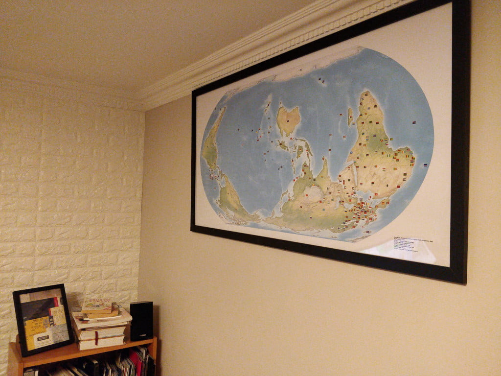
I'm delighted to announce that I've actually finished a project! Over the last few years, I've been designing a custom map. As per the credo of the "Organization of Cartographers for Social Equality", this map uses the Equal Earth projection to ensure proportional land-mass size, the South is at the up, and - of course - the globe has been rotated to 150°. I've had it printed and I think it …
Continue reading →
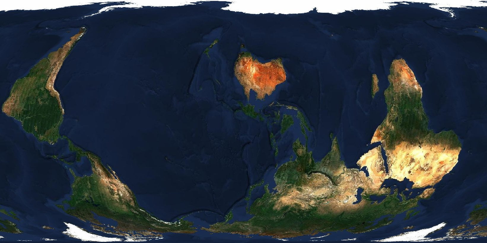
Regular readers know, I'm Creating an "Organization of Cartographers for Social Equality" map. I've already had some success using an existing NZ Centric, Equal Earth Map. And I've programmatically created a correctly projected map with R. But is it possible to do this with Satellite imagery? YES! Install gdal For this to work, you'll need GDAL - the Geospatial Data Abstraction Library.…
Continue reading →

Yup - I'm still banging on about this! This time, in R Result The colours are wrong, and the labels need adjustment - but not bad for a few lines of code! Code library(tidyverse) library(rnaturalearth) library(rnaturalearthdata) library(sf) centre <- 160 # NZ mostly centred, prevents Africa and South America wrapping. projection <- "eqearth" # Other good projections are wag1 wag7 eck4…
Continue reading →

(Yes, I'm back on my bullshit!) Regular readers may remember that I'm trying to create an "Organization of Cartographers for Social Equality" map. That is, a map with a Gall-Peters Projection and with South up. Oh, and Aoteroa centred. For reasons. I've got one step closer! I wasn't able to find and decent Peters projection map tiles, but I did find the next best thing. The "Equal Earth"…
Continue reading →

If you've seen that episode of The West Wing, you'll remember this scene: I'm not a paying member of the OCSE, but I fully support their aims. Because messing around with maps is fun. So, can I build a web-first maps which is South-up, Pacific-centred, and Peters-projected? Here's what I managed to do using OpenLayers - an Open Source web maps library which is pretty hackable. Get started …
Continue reading →