Today was quite the accidental milestone! I've edited OpenStreetMap over a thousand times!

For those who don't know, OSM (OpenStreetMap) is like the Wikipedia of maps. Anyone can go in and edit the map. This isn't a corporate-controlled space where your local knowledge is irrelevant compared to the desire for profit. You can literally go and correct any mistakes that you find, add recently built roads, remove abandoned buildings, and provide useful local information.
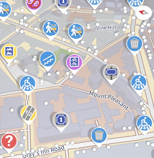
Editing the full map is... complicated. For simple edits like changing the times of a postal collection, there are simple forms you can fill in. There's also an aerial view so you can drag and drop misplaced locations. But for anything more complicated than that, you'll need to spend some time understanding the interface. There's a friendly community who are happy to check or correct your submissions.

I'll be honest, I don't use the web editor much. Instead, I use the Android app StreetComplete. It's like an endless stream of sidequests. As you travel through the world, it will ask if a shop is still open, or if the highway is lit, or how many steps there are on a bridge, or whether a playground is suitable for all children, or if restaurants serve vegetarian food, or if a bus-stop has a bench, or... the list is almost endless!
I use it when I'm walking around somewhere new, or on holiday, or waiting for a bus. I used it so much that, for a short while, I became the #1 mapper in New Zealand!
So get stuck in! Make mapping more equitable and more accurate.
15 thoughts on “1,000 edits on OpenStreetMap”
@Edent
1st)Thank You!
probably did mention it before: We created a huge huge ActivityPub Atlas from OSM mapped to wikidata and others.
But what is the goal?
Even more #OpenStreetMap #ReDeCentralize !
For redaktor and taxiteam we do federated geocoding cause you can imagine that the local bike/delivery/cab cooperative got the best local insights.
[DE: just btw Deutsche Post switches to OSM but anyway] :
You can also edit the data right from the fediverse cause the instance got some service actors for the map part and to infer from LD what change goes to OSM, wd etc.openstreetmapredecentralize
| Reply to original comment on digitalcourage.social
@Edent Kudos mate!
| Reply to original comment on mamot.fr
@Edent I use the web editor mostly; anything terrain-related (mountain bike double and singletracks, access tracks, etc.) is way more accurate using aerial photos, the French IGN path database, the river database, etc.
Then I use StreetComplete when in a city.
| Reply to original comment on mamot.fr
@Edent
Well done!
I've also been using #StreetComplete.
I've done quite a lot of updates. All the remaining quests near my house are for shop opening times, which I don't feel the urge to do, cos they can change so often.
I occasionally use StreetComplete elsewhere, when I'm walking by myself, but it seems rude to be doing continual updates if I'm walking with others.streetcomplete
| Reply to original comment on mastodonapp.uk
Smart idea! Wonder if there's anything like this on iOS...
| Reply to original comment on bsky.app
@blog I’ve gotten into adding bike racks lately (in the generally well-mapped SF) via Go Map!! and it has been very satisfying.
| Reply to original comment on social.coop
@Edent I used to do a lot more editing, recently I've found things like Street Complete and Every Door on the phone have helped to get me back into mapping, which is nice. Lots of occasional edits and details now. No blank canvas like when I started.
| Reply to original comment on mastodon.green
@blog Congratulations!👏
| Reply to original comment on framapiaf.org
@Edent After reading this blog post I downloaded it. It's like Pokemon Go for grown ups and it gets to do some good. I haven't had this much fun for ages.
| Reply to original comment on mastodon.radio
@Edent "NO! Give me a couple of minutes, I need to make a detour to find out what this road is made out of!"
| Reply to original comment on mastodon.radio
matkoniecz
Glad to see StreetComplete being used!
(I contributed to it - and it is always nice to see it appreciated!)
@blog Nice! It feels good to update common knowledge.
I just recently started using online editor to add local POIs like benches and water taps/sources.
| Reply to original comment on mastodon.social
@blog if anyone is new to OpenStreetMap, @organicmaps might be a nice way in, FOSS mapping/navigation on iOS/Android and an in-built mechanism for submitting changes to OpenStreetMap, which is the basis of its maps
| Reply to original comment on mastodon.social
@blog for folks on iOS @everydoor is a great alternative too for on-the-go surveying and editing data points.
| Reply to original comment on scholar.social
More comments on Mastodon.
Trackbacks, Pingbacks, and Boosts
[…] Eden celebrated 1,000 changesets on OpenStreetMap. He reflected on his journey, his contributions, and the value of […]