I'm delighted to announce that I've actually finished a project!
Over the last few years, I've been designing a custom map. As per the credo of the "Organization of Cartographers for Social Equality", this map uses the Equal Earth projection to ensure proportional land-mass size, the South is at the up, and - of course - the globe has been rotated to 150°.
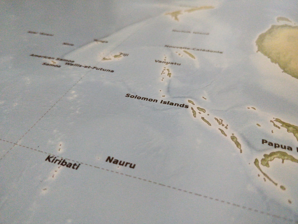
I've had it printed and I think it looks glorious!
Hanging on the wall
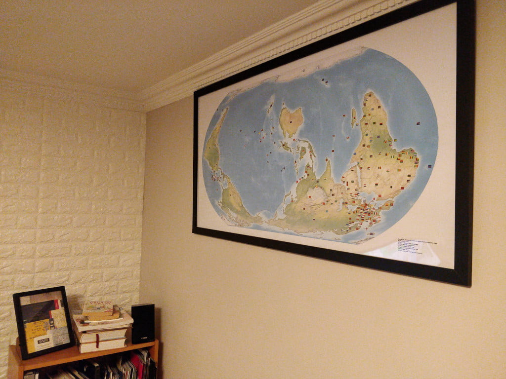
You can buy these maps from RedBubble.
Details
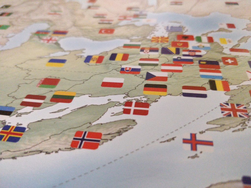
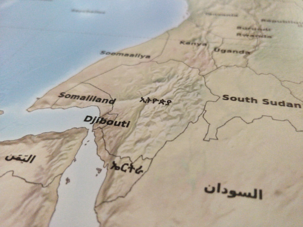
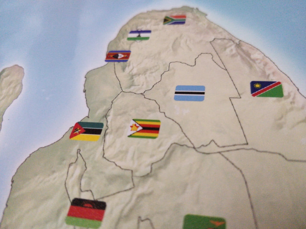
Buy
This is a large poster - I recommend buying the 120cm by 60cm version. It needs to be that size in order to make the country names legible. The cost per poster depends on your locale and whatever promotions RedBubble are doing.
These are not limited editions! I will print off as many as people order. Each one comes with a small inscription in the corner saying what the map is, and some other metadata.
As per below, you can download the assets in vector or raster format if you'd like to try printing them yourself.
Disclaimer
Maps are contentious. Some countries don't recognise other countries. Some borders are disputed. Some people clamour for reunification, some for secession. Some countries have a name given to them by their colonial oppressors. Some have been renamed by mad tyrants. Some countries have multiple names in different languages. Some are still fighting bloody wars in order to be recognised. Flags also suffer from the same problem.
The good news is that this is not an official map - my choices have no geopolitical consequences. The even better news is that the code behind the map is open source - so you can redraw it to your heart's content.
I have used the borders from Natural Earth, the country names from OpenStreetMap, and flags from Twemoji. If you dislike any of those, please direct your complaints to them.
Bugs
There are a few of things which have left me slightly dissatisfied.
By convention, most maps use Shaded Relief with the light coming from North-West. However, because this map is flipped, it cause an optical illusion which make mountains look like ravines and vice-versa. As noted:
Viewing images that do not conform to this convention may show a form of convex–concave ambiguity. Wikipedia page on "Top-Left" lighting
If you know how to redrawing or recalculate the shade, please let me know.
Secondly, in their default placement, country names and flags overlap. For example:
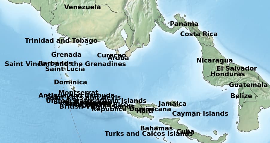
I manually adjusted the placement to keep labels and flags roughly in the right place without overlapping. I think I was accurate, but if you spot any mistakes - or know how to automate this - please let me know.
Non-Contiguous countries aren't handled well. For example, Alaska is unlabelled because it physically separated from the rest of the USA. The same is true of overseas territories like the Canary Islands and French Guiana.
The various seas, oceans, and other bodies of water aren't labelled.
I'm sure you will spot a few other errors. Either leave a comment here or raise an issue on GitHub.
How
This was a multi-stage process - mostly involving R.
Background
The background image comes from "Color terrain art without type halos". It's a TIFF which has been rotated and converted to PNG.
mogrify -rotate 180 Equal-Earth-Physical-Relief-No-Halos-150E.tif
convert Equal-Earth-Physical-Relief-No-Halos-150E.tif EE-SU.png
Country Names
Natural Earth only provides country names in English ☹ - but it also provides 2 character ISO codes. So I grabbed the country codes and names from OpenStreetMap and merged them into the data set using R.
The Code
This produces the country borders and names onto an SVG.
Manual placement
I used Boxy to edit the SVG and place all names in roughly the right place.
Conversion
Inkscape was used to open the resultant SVG at 72dpi. I then used Gimp to autocrop, canvas expanded to 16000x9000, and saved as an uncompressed PNG.
The Emoji wouldn't import to either Gimp or Inkscape. So I viewed the file in Firefox and then printed it to a PDF. That PDF was cropped using pdfcrop and then imported to Gimp.
Some print shops require CMYK colour spaces - convert Export.png -colorspace cmyk Print-CMYK.tif
Copyright
All of the Equal Earth data has this copyright:
The Equal Earth Physical Wall Map is in the public domain. You may use the map any way you like, including modifying the content, reproducing it on any type of media, republishing it, and selling it for profit. Consider the map as yours. By downloading and using this map you agree that the map author (Tom Patterson) is not legally responsible for any errors that the map may contain. You are solely responsible for all problems that may arise from reuse of the map and its redistribution to third parties. Tom Patterson does not endorse the individuals or organizations that may use the map, nor does he endorse their positions on various issues.
It builds on Natural Earth, which is also public domain.
The Emoji flags are either CC BY or MIT - depending on whether you think SVGs are images or code.
In a similar spirit, the code that I've used to create my variation of the map, and the resultant output, is also hereby placed in the public domain. You may treat it as CC0.
South Up, Aotearoa Centred, Equal Earth Projection Map by Terence Eden is marked with CC0 1.0 Universal
Download
You can download all the code and assets from GitHub.
5 thoughts on “You can now buy my South Up, Aotearoa Centred, Equal-Earth Projection Map”
@Edent
I'm reminded of CJ's comment in the West Wing episode where she was shown a south-at-top map...
"But it's WRONG!" ;-p
| Reply to original comment on fedimon.uk
@Edent .. grumbling that Dymaxion is The One True Way(tm)...
| Reply to original comment on hear-me.social
If you fetch country names from Wikidata (resolvable from ISO codes), you can do so in multiple languages.
Want an upside-down a world map in Welsh, Catalan, or Arabic? Wikidata has you covered.
Kevin McDonagh
I feel doubly educated today 'Aotearoa' & 'South Up'!
@blog This is brilliant Terence!
| Reply to original comment on mastodon.social
More comments on Mastodon.